| Terminal Specifications | ||
| MGO Lines & Rates |
(1) 12 inch lines (1) 20 inch lines (2) 6 inch lines |
(1) 5,000 bph (in-bound) (1) 15,000 bph (in-bound) (2) 1,500 bph (out-bound) |
| FO Lines & Rates | (1) 24 inch line (4) 12 inch line |
(1) 17,500 bph (in-bound) (4) 3,500 bph (out-bound) |
| Maximum Tanker Draft | 13 meters (mlws) | |
| Total Capacity | 2.120.000 | Barrels |
| Number of Tanks | 16 | |
| Tank Capacity | 50,000 bbls (4 tanks) 100,000 bbls (6 tanks) 220,000 bbls (6 tanks) |
7,950 cbm (4 tanks) 16,000 cbm (6 tanks) 35,000 cbm (6 tanks) |
| Products | FO & MGO | |
| Barges | 4 | |
| Tankers | 1 | |
| Pier | ||||||||||||||||||
|
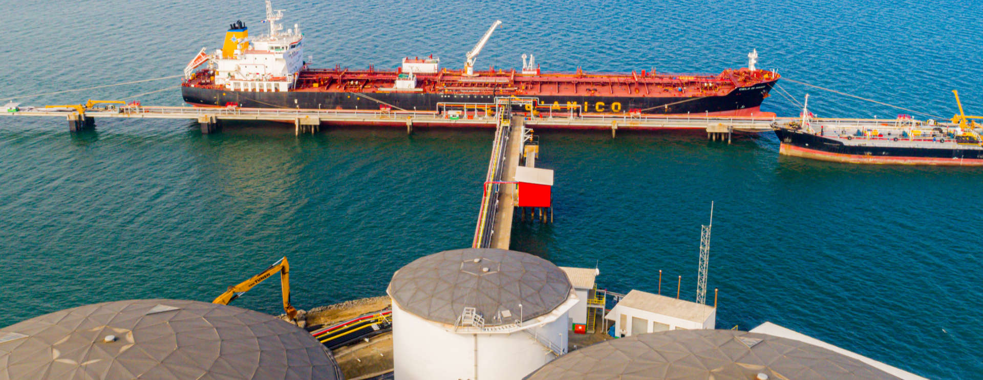
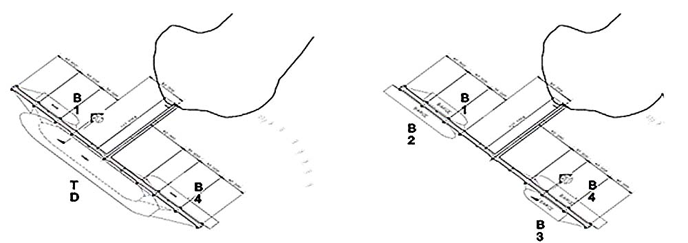
Melones Oil Terminal, Inc. has a pier that extends from the southern corner of Melones Island in a southwesterly direction. The pier is arranged in a simple T-shaped dock at the end of the structure towards the sea as shown in the image below.
The pier is designed to operate as follows:
|
||||||||||||||||||
|
||||||||||||||||||
Design Size of the Boats
|
|
Location
Melones Oil Terminal, Inc. is located on Melones Island in the Gulf of Panama. The geographical position of Melones Island is 8° 49.9’ North 79° 36.4’ West and is the only marine facility on the island. |
|
Melones Island is located:
Melones Oil Terminal, Inc. is located outside the jurisdiction of the ACP, but within the waters under the jurisdiction of the AMP. Its approach can be found on the following commonly available navigation charts:
|
Address
Phone Numbers
+507 395-6311
+507 395-6312
+507 395-6315
Fax: +507 395-6316
+507 395-6312
+507 395-6315
Fax: +507 395-6316